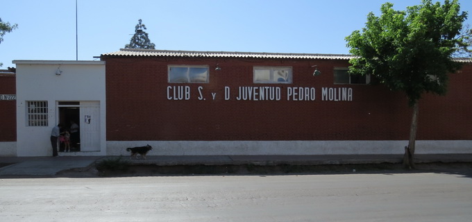
3- Pedro Molina
It is limited in the north by Mathus Hoyos Street, in the south by Correa Saa Street, in the east by Mitre Street, and in the west by the Costanera Avenue.
With an area of 1.5 square kilometres and a population of 10132 inhabitants, its population density is 6755 inhabitants per square kilometre.
There are three schools, a police station and it does not have any health centres.
Pedro Molina is closely tied to the foundation area of the city of Mendoza, since those years, there has had a constant growth by parcels that can be tracked back to 1920, during the decades of 30-40 and 40-50, the district was consolidated.
The Costanera Avenue is a route of Inter-departmental connection; it constitutes the entrance of the department from the north. The main streets in a western direction are Pedro Molina, Aristóbulo del Valle, and Correa Saa. From north to the south: Mitre. The secondary arteries are Francisco de la Reta, and Húsares.
The history of the District begins with name of Media Luna, which is the name that given to the ranch that there used to be in the district of Pedro Molina de Guaymallén. This name originated due to the course of the Channel Zanjón that produces a semicircle similar to a crescent moon. In that place, before the foundation of the city of Mendoza, there used to be the Pucará de Caubabanete, called by the Huarpes Indians, a kind of construction or fort that the Naturalists ones said had been constructed by the expedition of the Inca Empire and it seems that “Caubabanete” was the name of the general cacique of those times. There the captain Don Pedro del Castillo stayed, on May 2 1561, with his expedition to the valley of Huentata, a few days before founding the city of Mendoza; the Pucará was named in the captain Pedro del Castillo in one of his writings with the name of Los Paredones.
4-El Bermejo
It is limited in the north by the Cacique Guaymallén Canal, in the south by the Mathus Hoyos Street, Teniente 1º Ibañez, Capilla de Nieve, Servet, and Virgen de las Nieves, in the east by the Victoria Street, Professor Mathus, and the Railroad General San Martín.
With an area of 5.25 square kilometres and a population of 13428 inhabitants, its population density is 2558 inhabitants per square kilometre.
There are four schools, a police station, and a health centre.
The District Bermejo is part of the Complementary area: Patrimonial Preservation Area. It is protected by several decrees that regulate the growth of the district, protecting it from activities that could damage the local environment. This District is considered a park and has great poplar trees. Plastic artists of a recognized trajectory have established themselves in this area along the Mathus Hoyos Street, for example the teacher Luis Quesada.
The Mathus Hoyos Street is the Provincial Route 24; the Avellaneda Street is main road. The street Allayme is one of the main roads that create a connection with the Belgrano district.
The history of the District: the Huarpes used to call the lands nowadays known as Bermejo, “Cuascarile” which means the “Quiet Green”. When the Spaniards arrived there was the Cacique “Ycano” and then came and were established the captains and settlers Escobar Torres and Perez de Marcotegui (around the year 1570). In 1650, they were possessions were transferred to the captain Juan de Nieves y Castilla, that found his farm and built a chapel. Therefore, it became the “Capilla de las Nieves” and the other villagers called it “Capilla de Nieves” in honour of the Virgin of Nieves. In 1710, it became the vice-parish of Guaymallén, and some time later, it became a possession of the Dr. Manuel Bermejo, a public man of Mendoza.


