It was created in 1985. It includes 20400 hectares and protects the largest area of native forests in the province. It is located on the plains in the North-central area of the province of Mendoza, in the so-called Guanacache Crossing. The climate is is typical of desert areas with wide variations in temperature with very hot summers and cold winters. The temperatures range from 40-42 degrees Celsius in the summer and as low as -10°C in the winter.
The region has a great biodiversity, despite being located in the most arid zone of Mendoza (150mm of annual rainfall).
The name of this reservation comes from the language huarpe Chrein or Teñc = mature and Chreca or Teak = fruit or seed, interpreted as a ripe fruit, possibly the carob tree as this was the base of the diet for these tribes.
From the biological point of view, the reservation is located within the phytogeographic province of Monte and has the influence of the wetlands species.
The park rangers’ base is called El Pichón, and there is a very interesting interpretation centre.
The basic idea behind the creation of this reservation was the preservation of the sweet carob (Prosopis flexuosa) forest. This species is the most abundant tree in the area, and it forms open forests of dispersed trees. Depending on the groundwater (water tables) which is at a depth of about 10 metres, this forest dominates the low altitude sites or low dunes. This latter feature can be seen in the “altos limpios” (clean dunes), which because of their height (up to 15 metres) only allow the growth of the carob in the spaces between the dunes. This vegetation is called “freatófito forest” because the adult carobs get their water mainly from the water table levels.
The carobs from this region are the highest native and wild trees in Mendoza, and the oldest specimens reach up to 15 metres. The forest, in general, is open and it becomes denser in the paths or channels of temporary rivers. It is assumed that the forests in the area were not as heavily deforested as in other areas because the dunes hinder access to exploitation by Man. The cutting of trees was intense at the beginning of the 20th century to produce coal (for the train and for the lighting of the city). The carob wood is hard and has a high caloric potential.
The sweet carob is the key species in the Telteca ecosystem since its protection ensures the conservation of a large number of plant and animal species (“umbrella species”). Its ecological functions within this ecosystem are the most varied: it is a source of food for herbivorous animals (mara, cuises, field mice, viscacha), both due to their leaves and for its nutritious fruit in sheath. Its leaves provide nesting sites, they favour reproduction and care for territories behaviours for a large number of bird species; their peripheral thorny branches, reaching to the ground, provide shelter for small animals that build dens under their treetops. In addition, this tree provides shade. Many insects that are attracted by their flowers, fruits and trunks are a rich source of food for birds, lizards, predator insects and spiders.
The first settlers known in the region were the Huarpes who used to use the resources provided by the lakes and mountains efficiently.
With the growth of the farming oasis, the groundwater that fed the lakes reduced so they dried up. After that, at the beginning of the 20th century, there was a period of indiscriminate logging for the supply of coal, firewood and wood. The breeding of livestock meant another impact. The creation of the reservation and the controlled use of this ecosystem allow us now to appreciate a recovering forest, which every day is closer to what it was originally.
The current villagers take full advantage of this environment using the firewood, the fodder plants for breeding goats mainly and jonquil to make wefts for different purposes. The chañares and carob fruits are edible and the fauna, in general, is a good source of proteins for those people. In the swamps of Guanacache and El Rosario, the ancient inhabitants would fish perch, fish sought because of its very tasty meat. In addition, this is where the wheat crops began in Mendoza at the beginning of the 20th century.
As was pointed out in the reservation Ñacuñán, the dunes cover the areas in the north and east of the province, virtually continuously, and are interrupted only by the Tunuyán and Mendoza rivers beds and reservoirs, and the areas of salt marshes and marshlands of the rivers Mendoza, Desaguadero and San Juan. The marshes occupy a vast extension of lands in the northeast.
The existence of groundwater at a relatively little depth, between 8 and 20 metres, allows the irrigation of the “freatófitos” trees as the carob.
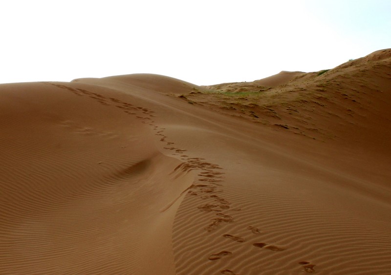
As a special feature of this reservation there is, a series of dunes, exceeding 15 metres, called “Los Altos Limpios” (dunes without vegetative cover). The lack of coverage may be due to intense clearing practices in the past, but some researchers suggest that this would not be sufficient to justify it. It has been suggested that, at the location of the dunes, there is a particular condition of the prevailing winds, which present more than one direction and greater intensity, which would prevent either the reforestation or the migration of the dunes.


