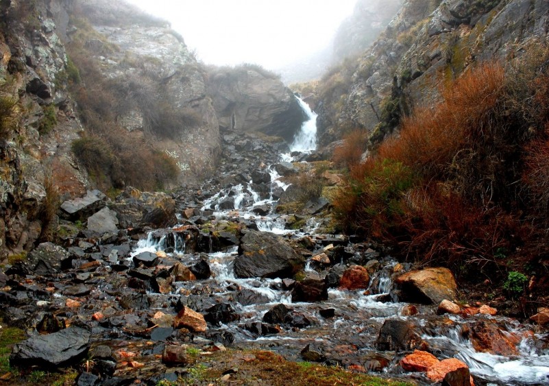
The Divisadero Largo reservation includes 492 hectares, and is located in the foothills of the Pre-ridge of the Andes, 8 kilometres west of the city of Mendoza, between the departments of Capital and Las Heras. It was declared a Protected Area in 1983. Its name refers to Cerro Divisadero, from which the natives would watch the transit of herds of guanacos and other animals in order to hunt them.
The main purpose of creation of this park was the presence of sedimentary outcrops with fossils formed during a period of more than 200 million years.
The park rangers’ base is called Atala, name of the mine where coal used to be mined at the beginning of the 20th century.
The reservation has unique geological features, which give it a great beauty and a high value both scientific and educational. The presence of a geological fault (fracture) and its movement have allowed the outcrop of different levels of sedimentary rocks representing an interval of time greater than 200 million years.
Divisadero Largo invites us to make a trip back in time, to make contact with the very old history of our region. The evidence of diverse environments and fossils of animals and plants that lived there in the past, perhaps, will help us not only to capture the intense dynamics and diversity of our planet, but also to establish a closer relationship with the environment that surrounds us.
The rocks in the area are part of the so-called “Cuyo Basin,” which in the past was a huge depressed centre that favoured the accumulation of sediments. These conditions occurred from the Triassic period, more than 200 million years (age when dinosaurs first appeared) and continued with various intensities until mid-Tertiary period (about 200 million years ago) when the dinosaurs had disappeared and the mammals were dominating the surface of the Earth.
All of these materials were formed under continental environments: rivers, lakes, lagoons, estuaries, saline environments, and alluvial fans were alternately occupying the region and left over the time huge volumes of sediments. Finally, the Pre-ridge contributed with a lot of material covering the ancient formations, after the elevation of the Andes Mountains, in the Quaternary period (covering the past 2 million years).
The current flora and fauna of the foothills ecosystem are extremely diverse. The explanation lies in the fact that this region is a biome, namely, the boundary between two ecosystems or bio geographic regions, one typical of the plain (Monte) and the other from the mountain itself (Prepuna).
Therefore, being a biome, there simultaneously live plant and animal species from both regions. Among the typical species of the plain there are carobs, chañares, breas, and animals such as the small gray fox, ñandús, martinetas, and among the characteristic species of the mountain we found many cacti, yales, piquitos de oro, red foxes, the Andes suri, condors, and mora eagles. Both the ñandús and the Andes suri have currently disappeared from the reservation.
The reservation includes three altitudinal levels of vegetation that dominate in the foothills. The lowest floor (up to 1200 metres above sea level) presents the lowest rainfall rates and is dominated by jarillales. This plant community is very poorly represented eastward. The vegetation is very sparse leaving a lot of bare soil surface. There are other shrubs, all from extremely dry environments, such as retamos, garabatos, zampas and llaullines among others. The substratum of grass is quite open and besides that, there are several species of cactus.
More than 4000 students annually visit the reservation, in addition to the nearly 11000 nature lover tourists who visit and do different activities such as hiking and biking.


